Stansbury to Edithburgh
Distance: 29.2km (7 hours 20 minutes)
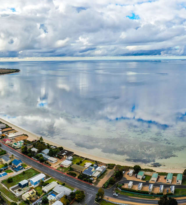
Starting at Stansbury’s foreshore, following the existing town trails around the point, along the back beach and south away from town. Along this trail, you can view historic interpretive signage, and information about flora & fauna.
From Pitts Cutting, you will be able to see Kleins Point in the distance, a limestone quarry operated by Adelaide Brighton Cement. On certain days, the Accolade 2 will be in port, to ferry the limestone across to Birkenhead. The trail moves away from the coast at Pitts Cutting where it heads inland to join the highway for a short distance before detouring towards Wool Bay.
Whilst this section is a total distance of 29.2 kilometres, you can break it down into 3 smaller manageable walks and all trails are shared for walker & cyclist:
- Stansbury to Wool Bay 14km (3 hours 39 minutes)
- Wool Bay to Hickeys Point 5.5km (1 hour 23 minutes)
- Hickeys Point to Edithburgh 9.4km (2 hours 18 minutes)
Wool Bay was named because it had a cutting wide enough to roll a bale of wool down to beach, before it was loaded onto a ship bound for Port Adelaide. It is also well known for the remains of its iconic lime kiln, the only 1 of 6 remaining which can still be seen on the cliffs above the town jetty.
Leaving Wool Bay, head south towards Coobowie. On the right hand side just before the grain depot is Barachel Alpacas, part of the Yorke Peninsula Home Grown Trail; here baby alpacas are on site most of the year and you can cuddle & feed them (be sure to call ahead first, as this is also a working farm).
Just a little further on is Port Giles, a deep sea port for transporting grains all over the world. Spring & summer time means harvest with lots of grain truck bringing their loads to Port Giles, so be careful walking or cycling. You can fish off the Port Giles Jetty, but as it is a working port, only when there is not a cargo ship in port. If you would like to fish off this jetty while on Walk The Yorke, check access at portmis.flindersports.com.au.
Hickeys Point is just a short walk from Port Giles, and has a Walk The Yorke shelter (one of many around the whole region). It’s a favourite boat launch area for fishers looking for a seafood catch.
Following the trail signage around, continue on to Coobowie. Originally called Deception Bay, early settlers once considered it the location for a big city, but changed their mind once they could not find any fresh water sources. Coobowie also made the record books in 1848 when 3 bushrangers, who had escaped from Tasmania, wrecked their boat off Kangaroo Island before arriving at Coobowie in a stolen boat; an Inspector Tolmer arrested them, before they were escorted back to Tasmania and hung.
At the southern edge of Coobowie, is the causeway and bird hide, with the causeway home to many migratory birds and a key breeding area for fish stocks. Installed by the local progress committee, the bird hide offers a view of bird feeding at the low water line in the Coobowie Estuary, pick up a bird identification brochure from the General Store or Caravan Park and become an ornithologist for a while.
Follow the trail as it winds its way along the coastline towards Edithburgh, where you’ll come to the golf course on the coastal side and the Edithburgh Cemetery on the other.
Edithburgh Cemetery is believed to have the largest mass grave in Australia – that of the 31 Lascar (Filipino & Indian) seamen who died in the Clan Ranald shipwreck in 1909. They were buried in one large grave marked ‘names unknown’ until 2009 (the 100th anniversary), when a plaque listed the name of each seamen.
Edithburgh was once the 3rd busiest port in South Australia, with salt, lime and gypsum all shipped to Adelaide from the jetty. Visit the Edithburgh Museum for an insight into the thriving mining and shipping industry that once operated from Edithburgh.
If you feel like a swim, just along the beachfront from the jetty is the Edithburgh Tidal Swimming Pool. Built in the 1930’s by a ‘work for the dole’ group, and with local farmers donating labour & stone, the pool is a popular spot during the warmer months.
To help plan your walk, download the Stansbury to Edithburgh map.
Continue on to the next section of Walk The Yorke – Edithburgh to Port Moorowie, or search other trails on Yorke Peninsula.
All distances are one-way, as Walk The Yorke is a continuous linear trail covering more than 500kms.
Walking Distances & Times
Total length 29.2km (7 hours 20 minutes); or broken into 3 smaller sections:
- Stansbury to Wool Bay 14km (3 hours 39 minutes)
- Wool Bay to Hickeys Point 5.5km (1 hour 23 minutes)
- Hickeys Point to Edithburgh 9.4km (2 hours 18 minutes)
Trail Notes & Important Information
- For cyclists, the marked trail follows a sealed main highway for part of this section.
- At the intersection of Haywood Park Road & St Vincent Highway, cyclists will follow St Vincent Highway. Please take care and be aware of traffic including B-double trucks.