Point Turton to Port Rickaby
Distance: 41.6km (10 hours 25 minutes)
Heading towards the north from Point Turton, this section of the Walk The Yorke trail can be broken down into 5 smaller trails:
- Point Turton to Hardwicke Bay Shelter 14.1km (3 hours 32 minutes)
- Hardwicke Bay Shelter to Port Minlacowie 7.4km (1 hour 51 minutes)
- Port Minlacowie to Parsons Beach 10.2km (2 hours 33 minutes)
- Parsons Beach to Bluff Beach 2km (30 minutes)
- Bluff Beach to Port Rickaby Jetty 7.9km (1 hour 59 minutes)
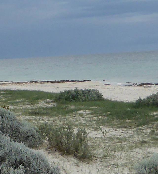
In the first part of this section a beach walk takes walkers along firm beaches with rock outcrops, while cyclist following the road network to Hardwicke Bay. Just north of Point Turton, walkers will come across Flaherty’s Beach, a stunning beach located between Hardwicke Bay and Point Turton on the western coastline.
Heading further north, Hardwicke Bay is a fantastic small coastal town, and the tractors lined up on the beach are always a sight to behold. With no concrete boat ramp here, the best option is to use a tractor to launch your boat and the colourful line-up of tractors is a Hardwicke Bay tradition.
The trail continues north, and varies between a shared trail, beach walk and bike track; before splitting at Parsons Beach with walkers following the coastline, and cyclists along the roads.
Bluff Beach retains some important Yorke Peninsula maritime history, with boat hoists that were used by local fishermen to hoist their boat out of the water in bad weather. There are 2 boat hoists remaining following a storm in 1954, but there were 6 erected back in 1925.
From Barkers Rocks, keep heading north along the shared walking/cycling trail until you reach Port Rickaby.
Port Rickaby’s Jetty was built in 1879, with a length of 121.9m (400 feet) and a low-water depth of 3.3m; this meant that cargo could be loaded directly onto the international sailing ships, instead of being ferried by ketches.
To help plan your walk, download the Point Turton to Port Rickaby map.
Continue on to the next section of Walk The Yorke – Port Rickaby to Port Victoria, or search other trails on Yorke Peninsula.
All distances are one-way, as Walk The Yorke is a continuous linear trail covering more than 500kms.
Walking Distances & Times
Total length 41.6km (10 hours 25 minutes); or broken into 5 smaller sections:
- Point Turton to Hardwicke Bay Shelter 14.1km (3 hours 32 minutes)
- Hardwicke Bay Shelter to Pt Minlacowie 7.4km (1 hour 51 minutes)
- Pt Minlacowie to Parsons Beach 10.2km (2 hours 33 minutes)
- Parsons Beach to Bluff Beach 2km (30 minutes)
- Bluff Beach to Pt Rickaby Jetty 7.9km (1 hour 59 minutes)
Trail Notes & Important Information
- Parts of the beach walk section between Hardwicke Bay & Cockle Beach (in particular) can be rocky.
The beach can also have seaweed build up at certain times of the year. If you choose to walk to low tide, firmer sand will be exposed making for an easier walk. - When walking between Cockle Beach and Parsons Beach the designated walking trail is marked as an inland shared walk/bike trail, however there is an option to walk along the beach.
- If walking along the beach between Cockle Beach and Parsons Beach, please note that Watsons Beach may at times have soft sand and seaweed build up. Walking is best at low tide as firmer sand is exposed.
- For cyclists, the route between Flaherty's Beach & Hardwicke Bay follows the tracks adjacent to the sealed road and along a smaller section of the highway; whilst walkers follow the beach.
- As indicated on the map, cyclists can choose to head to Flaherty's Beach for sightseeing. The sand on Flaherty's Beach may at times be firm enough for cycling, however the marked & recommended cycling route is inland.
- Between Cockle Beach & Parsons Beach walkers & cyclists follow a shared trail along a sandy four-wheel-drive track that can be soft at times. Approximately 2km north of Watsons Beach Road, it can become grassy before becoming a two-wheel-drive dirt track. A suggested alternate route for cyclists is to follow Cockle Beach Road, Mount Terrible Road and Parsons Beach Road before re-joining the marked trail.
- The marked trail between Barkers Rocks & Port Rickaby can become sandy at times due to natural sand distribution from the nearby sand dunes. For cyclists who wish to avoid sand riding, an alternate route is to follow Barkers Rocks Rickaby Road and Croser Road.
- For cyclists, the marked trail follows a sealed main highway for part of this section.
- For approximately 1km between Point Turton & Hardwicke Bay, cyclists will follow Yorke Highway. Please take care and be aware of traffic including B-double trucks.